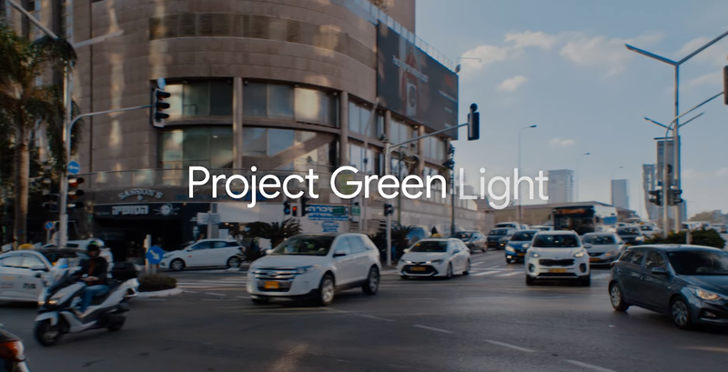
Green Light optimizes traffic lights to reduce vehicle emissions in cities, helping mitigate climate change and improving urban mobility
Road transportation is responsible for a significant amount of global and urban greenhouse gas emissions. It is especially problematic at city intersections where pollution can be 29 times higher than on open roads. At intersections, half of these emissions come from traffic accelerating after stopping. While some amount of stop-and-go traffic is unavoidable, part of it is preventable through the optimization of traffic light timing configurations. To improve traffic light timing, cities need to either install costly hardware or run manual vehicle counts; both of these solutions are expensive and don’t provide all the necessary information.
Green Light uses AI and Google Maps driving trends, with one of the strongest understandings of global road networks, to model traffic patterns and build intelligent recommendations for city traffic engineers to optimize traffic flow. Early numbers indicate a potential for up to 30% reduction in stops and 10% reduction in greenhouse gas emissions [1]. By optimizing each intersection, and coordinating between adjacent intersections, we can create waves of green lights and help cities further reduce stop-and-go traffic.
Launched in 2023, Green Light is now live in 20 cities across four continents, from Haifa, Israel to Kolkata, India to Hamburg, Germany and recently Boston, USA – and in these intersections we are able to save fuel and lower emissions for up to 47M car rides monthly.
Green Light reflects Google Research's commitment to use AI to address climate change and improve millions of lives in cities around the world.
How it works
1. Understanding the intersection
Building on our decades-long effort to map cities across the world, we can infer existing traffic light parameters including: cycle length, transition time, green split (i.e. right-of-way time and order), coordination and sensor operation (actuation).
2. Measuring traffic trends
We create a model to understand how traffic flows through the intersection. This helps us understand typical traffic patterns including patterns of starting and stopping, average wait times at a traffic light, coordination between adjacent intersections (or lack thereof), and how traffic light plans change throughout the day.
3. Developing recommendations for the city
Using AI, we identify possible adjustments to traffic light timing. We share these adjustments as actionable recommendations with the city. The city’s traffic engineers review the recommendations, approve them, and they can easily implement them in as little as 5 minutes, using the city's existing policies and tools.
4. Analyzing impact
We measure how many stops we’ve saved for drivers, and its impact on traffic patterns. We then use industry standards models to calculate the climate impact of these changes. We share this with the partner city and continue monitoring for any future needed changes.
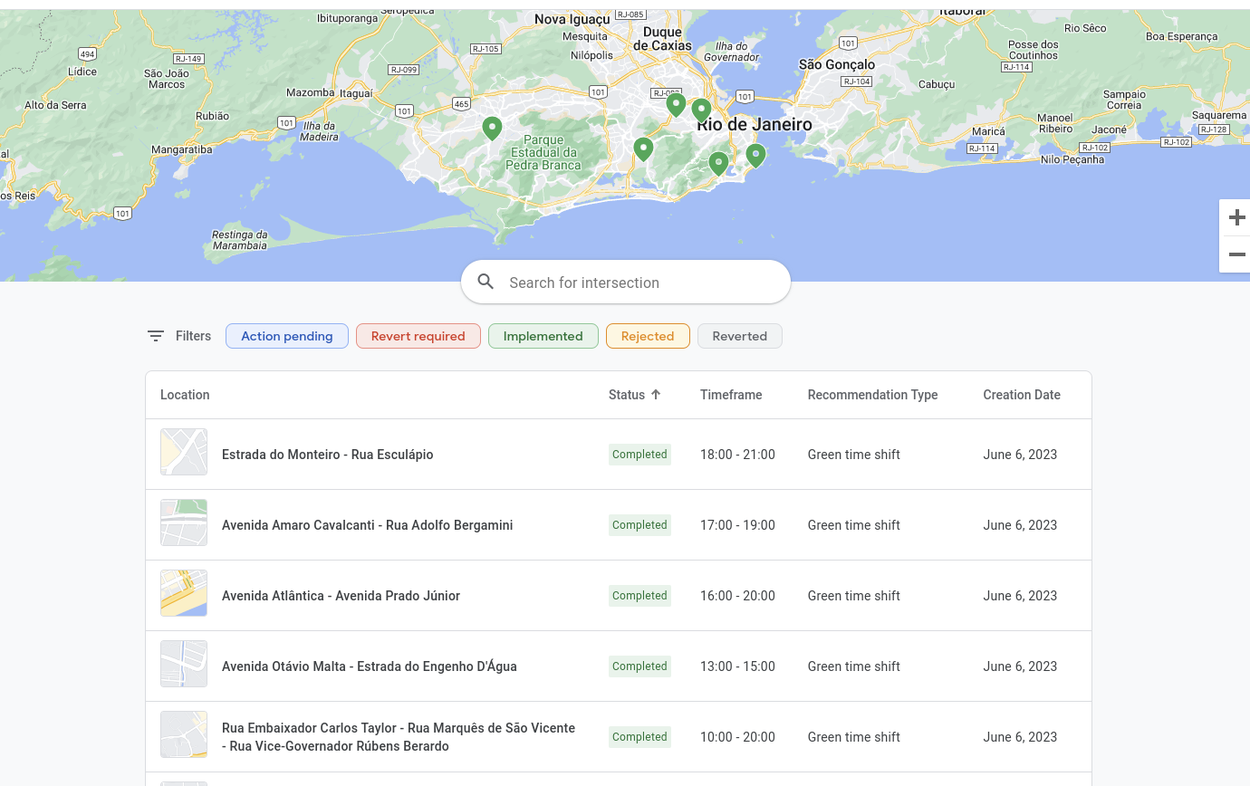
User friendly recommendation interface for partner cities
The Green Light dashboard provides city-specific actionable recommendations, showing supporting trends for each recommendation, with the option to accept or reject the suggestion. After a recommendation has been implemented, the dashboard shows an impact analysis report.
Why bring Green Light to your city?
- A simple, high-impact way for cities to go Green
- No additional hardware purchase, installation or maintenance required
- Automatic coverage, monitoring and optimization of intersections
- Trusted source of truth (based on Google Maps driving trends)
- Clear actionable recommendations and impact reports
- User friendly interface
If you are a city representative or traffic engineer and are interested in joining the waiting list, please complete this form.

Green Light has become an essential component of Kolkata Traffic Police. It serves several valuable purposes which contribute to safer, more efficient, and organized traffic flow and has helped us to reduce gridlock at busy intersections. Since November 2022, we have implemented suggestions at 13 intersections. The outcome is excellent as per the feedback from commuters and traffic personnel
Vineet Kumar Goyal
Commissioner of Police, Kolkata, India

Green Light identified opportunities where we previously had no visibility and directed engineers to where there were potential benefits in changing signal timings. This provided valuable insights for our city with 2,400 traffic signals. Both the Green Light and Transport for Greater Manchester teams brought expertise and ideas to the table to improve journeys and reduce emissions.
David Atkin
Analysis and Reporting Manager, Transport for Greater Manchester, England

The system collects, analyzes and presents information that otherwise would require lots of time and effort to manually process. Changes can bring immediate benefits. Green Light helps engineers in their decision making process and enables quick insights.
Anat Gilad
Director of the Traffic Control and Technology Management Division, Haifa, Israel
Green Light in the news


FAQs
We are currently in the early research phase and offering Green Light to partner cities at no cost. Our primary goal of this product is to support cities’ sustainability goals.
No, all recommendations are based on driving trends from Google Maps and are then implemented by the city using the city’s existing systems and equipment.
When we start working with a city, the Green Light algorithm investigates driving patterns through the city, uses insights from Google Maps, and provides recommendations for intersections to optimize, based on the expected impact of the optimization. For example, if a traffic light at a certain intersection is already on the best possible plan, the system would not provide a recommendation for it.
Green Light algorithms will continue to monitor all relevant metrics, and two weeks after implementation a full impact analysis report will be uploaded to the interface for city engineers to review.
Green Light only shares recommendations about how a city should optimize traffic light timing - for example if they should add additional seconds of “green time” to a particular part of the traffic light cycle. User data is never shared with the city or any other third party.
We use Google Maps driving trends and AI to create recommendations.
No. Our system offers better plans based on aggregated anonymous data to improve traffic flow for everyone: Google and non Google users, car drivers, taxi drivers, buses and all other users of the road.
Publications
-
(1) Carbon saving assumptions are based on: 1) Early data points that are averaged from coordinated intersections. We expect these numbers to evolve over time and look forward to sharing continued results as we expand. 2) Modeled using an emissions model from the Department of Energy, with a single vehicle type as an approximation for all traffic (not yet adjusted for local vehicle mix)


